Discuss your challenges with our solutions experts
Faked signals, real risks: AIS disruptions spread in the Gulf
Widespread AIS spoofing and signal jamming threaten maritime safety and global energy flows through the Strait of Hormuz
2 minute read
Authors: Matthew Wheatley, Ian Solis, Nilay Saxena
As tensions escalate in the Israel-Iran conflict, global attention is increasingly drawn to the Strait of Hormuz, one of the world’s most critical maritime choke points. This narrow passage is essential for the transport of waterborne oil and gas, making it a strategic focal point amid rising regional instability.
Read on for a breakdown of rising AIS spoofing, the ships going dark in Hormuz, and what it means for global oil flows.
Ships go dark amid threats
AIS disruption, once a tactic primarily employed by Iran to obscure tanker movements, has now become widespread across the Gulf. In recent days, the region has seen a sharp rise in electronic interference, including signal jamming, falsified AIS transmissions, and spoofed vessel locations. These techniques distort tracking data and obscure the true positions of ships. While some of this activity is deliberate and aimed at evading detection, other disruptions may be unintentional, caused by external jamming that affects nearby vessels. Tracking data also shows a growing number of ships transiting the Strait of Hormuz "going dark" in a clear strategic response to the heightened risk environment.
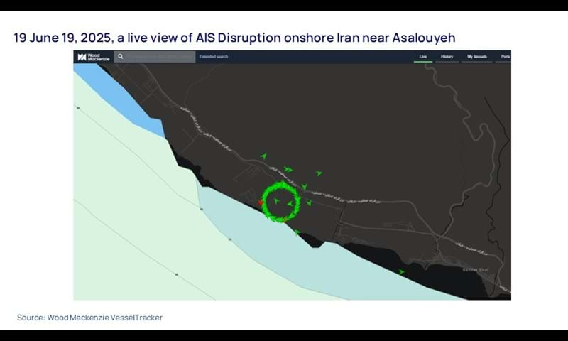
A wide array of AIS anomalies has been observed across the Gulf in the past week. According to VesselTracker data from 19 June, an unusually high number of ships were either listing the Iranian port of Asalouyeh as their destination or appearing to be berthed inland from the marine terminal. These are patterns consistent with spoofing activity. A closer examination of the AIS signals showed at least seventy-six vessels clustered in the vicinity of Asalouyeh. These included a broad mix of vessel types such as bulk carriers, crude oil tankers, LNG and LPG tankers, container ships, offshore support vessels, utility vessels, and tugs.
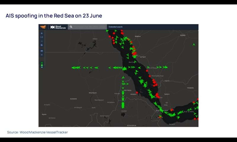
This situation also adds to the instability in the Red Sea, where persistent threats had already raised risks for vessels. As AIS interference expands, so does the risk of navigational errors and vessel collisions. These complications are compounding the hazards in an already volatile maritime environment. Altogether, these disruptions have significantly increased the cost and complexity of moving oil from the Gulf by sea. Insurers are raising premiums, and operators are facing mounting logistical challenges.
VesselTracker processes billions of AIS messages daily through the world’s largest privately owned receiver network and the only AIS-dedicated satellite constellation. With advanced auto-cleanse and correction algorithms, it enables accurate tracking of over 120,000 vessels worldwide each day. Designed to meet the diverse needs of companies, authorities, and individuals, VesselTracker delivers comprehensive maritime visibility on both local and global scales.
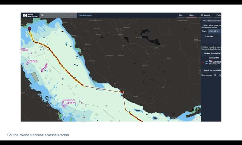
One of the vessels (the Gem No. 5) that was shown onshore near Asalouyeh in the live view continued to the Basrah Offshore Terminal to load Iraqi crude.
Get a deep understanding of the global commodity supply chain
Monitoring vessel and fleet performance can give you a competitive advantage whether you need to track the vessels themselves or their cargo.
Learn how VesselTracker can help you with all your shipping tracking needs.


