1 minute read
I want to be able to visualise all 3.5 million wells in the Lower 48 in real time.
That was the challenge Andrew Utz, Lens product manager, presented to Scott Sherwood, director of engineering, in late 2018. Andrew works closely with Wood Mackenzie's customers in the oil and gas industry in the Lower 48. They want to know just one thing – where to drill their next well. To answer that question, explorers need to be able to see the big picture – hot spots and trends – as well being able to zoom in on the details of specific sites and wells.
How to visualise 3.5 million wells in the Lower 48
Scott's gut response was it can't be done, not without sacrificing speed and performance. The number of wells is four or five times the number of pixels on the average computer screen. A standard map tops out at 30,000 to 50,000 data points. It looks something like this:
US Lower 48 Upstream Research Coverage Wall Map
A traditional printed oil and gas wall map of the Lower 48 producing basins and unconventional plays, identifying key plays and their overlaps. The map identifies the location for shale gas, tight gas and tight oil plays. In addition, detailed inserts show the IRR for nine key plays across the Lower 48. This wall map is an invaluable – but static – reference for anyone interested in the Lower 48 basins and shale plays.
How to turn 3.5 million data points into a competitive advantage
Scott and our team of computer scientists had to figure out how to give Andrew what he wanted – the ability to visualise and interpret 3.5 million data points – without actually giving Andrew what he wanted – a pixel-exploding CPU-incinerating 3.5 million data points.
Over the course of just a few months, the team entirely changed what’s possible in natural resources mapping. Here’s how:
Step 1: Get to the underlying customer-need
Business moves fast in the Lower 48. Having access to up-to-date and comprehensive data is table stakes. Being able to interpret the oil and gas well data accurately at pace is what gives explorers and investors a competitive edge. The team talked to our customers, watched them work and heard the following:
“I need to visualise and interact with all available oil and gas well locations on a map in order to understand big picture trends and hotspots. Interpreting numeric values on clustered markers is painful and does not give me an accurate geographic distribution the way individual points do.”
“I need to see all individual data points on a chart to give me confidence in trends and aggregations. This allows me to identify outliers and analyse data distribution while maintaining a broader context.”
Step 2: Describe the challenge
Experts in mapping, data visualisation and data processing came together to identify the challenge in turning a massive volume of raw data into user-friendly maps in real time. They broke it down into three parts:
- Processing: How to process oil and gas well data quickly and efficiently
- Shipping: How to group or cluster data points to make shipping easier
- Rendering: How to visualise data in a granular way to answer customer needs
Step 3: Investigate potential solutions
The team looked in all the usual places for potential solutions. It turned out our competitors weren't doing anything on this scale, either. Some of the big names in business intelligence were doing incredible things with data visualisation, but they weren't able to offer the seamless Wood Mackenzie Lens user experience the team was striving for.
Uber provided the breakthrough. Its real-time fleet maps display huge volumes of complex fleet and traffic data in a way that allows for rapid decision-making. That led the team to Mapbox, where they found Uber's former head of data visualisation, Nico Belmonte.
Nico was impressed by the work of Scott and his team.
I was amazed to see the level of sophistication Wood Mackenzie puts in their data visualization tooling. The Lens product team has done a masterful job layering large volumes of meaningful data that can be customized for specific data-visualization use cases.
Many of Mapbox's tools have been developed in open source settings. The collaboration between Mapbox and Uber on Kepler and Deck.gl provided a jumping off point for the team's work.
By leveraging industry-leading open source technologies we were able to stand on the shoulders of giants whilst maintaining our focus on meeting the customer need. The ultimate solution is an innovative combination of techniques and technologies: GPU-based parallel calculations, web graphics libraries and open-source streaming platforms.
Industry-leading maps in motion
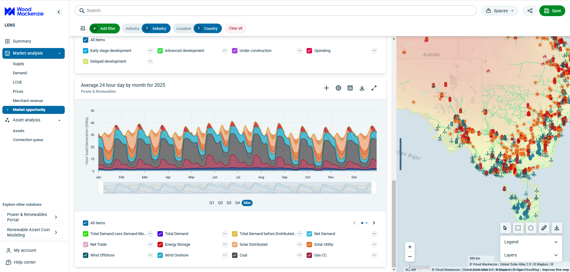
What's possible with our new mapping technology? You can decide what level of detail you need to see, add or remove layers of detail, choose the way you visualise data, and much more. It's available in Wood Mackenzie Lens®.
Our new natural resources mapping technology is part of Wood Mackenzie Lens®. It covers not just the Lower 48 but the globe with new layers and ways to visualise the data being added all the time. Sign up for a demo to see maps of the regions you’re interested in.
What’s next for mapping?
The vision for Wood Mackenzie Lens is to allow the user to cross reference data in real time to answer any natural resources question, whether it’s “where should I drill my next well?” or “how is the availability of gas and renewable energy going to impact coal demand?” The visualisation of geospatial data plays a critical role in answering questions like these.
How will maps keep up with the increasing volume of natural resources data and the interconnectedness of the energy chain? We’re already working on it. Find out more about what you can achieve with Lens mapping capabilities.


